

ENTERPRISE SOFTWARE FOR UTILITIES AND LOCAL GOVERNMENT
Real-Time
Esri Integration
No Need for Syncing.
We’re proud to be a long-time Esri partner with aligned vision and technology.


Live Maps, No Middleman
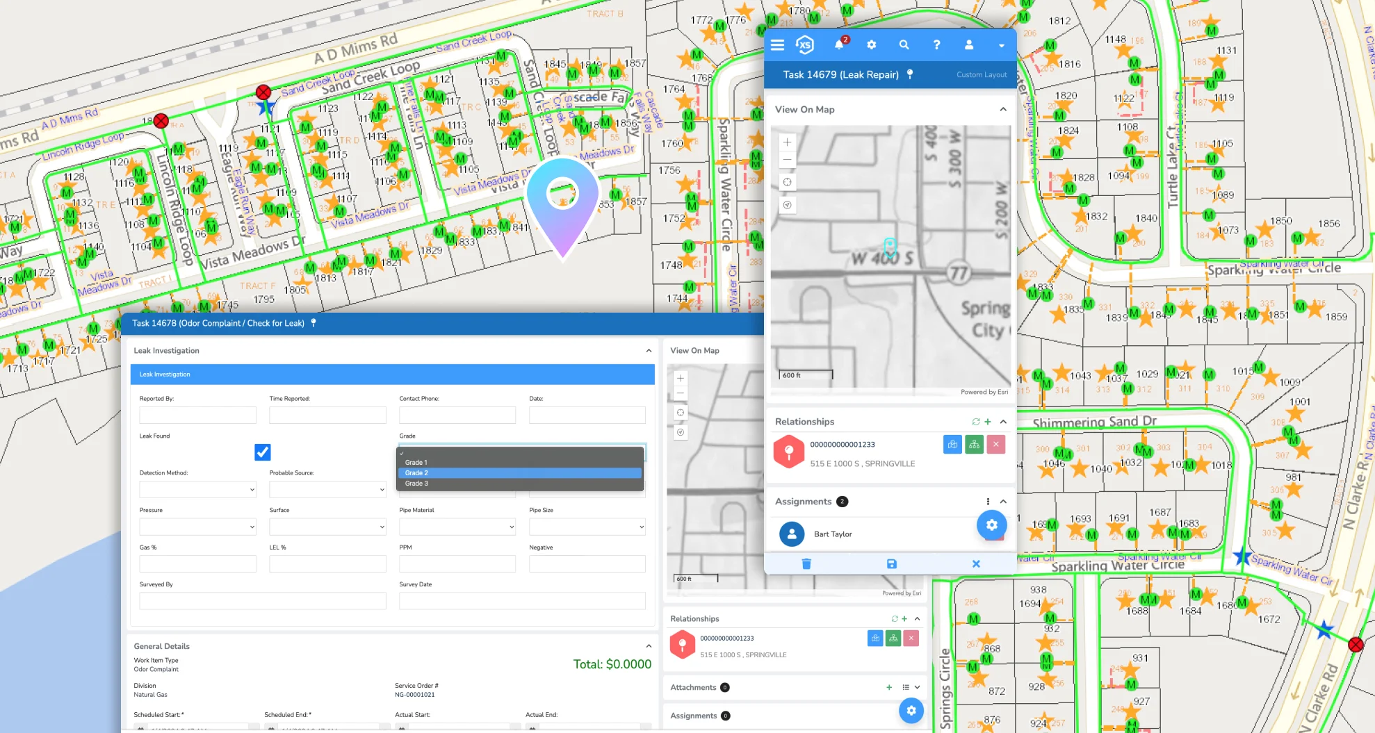
No sync jobs. No data duplication. Just a direct connection to your authoritative GIS. Use your existing Esri web maps, apps, layers, and services across the entire Elements XS platform—from the office to the field.

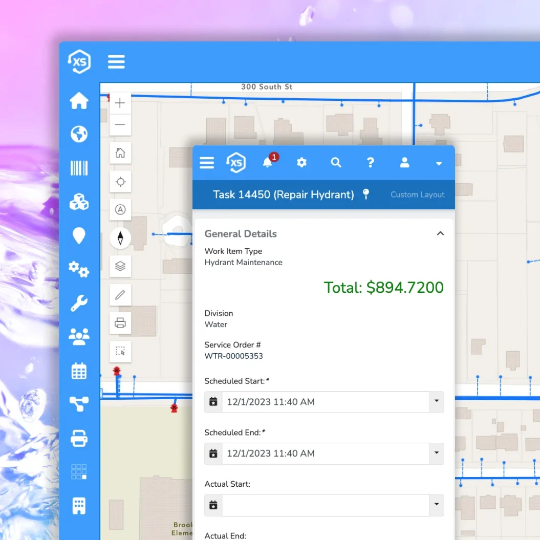
Maps That Actually Do Things
Every request, permit, inspection, work order, and utility record can be visualized on a map. Configure unlimited purpose-built maps tailored to users, departments, and workflows—all powered by your own Esri environment.

See the Big Picture
(and Every Detail)
See where things are happening and why. View permits, work orders, inspections, billing records, and more in one connected system. Use spatial intelligence to spot trends, prioritize work, and serve your community better—all while maximizing your GIS investment.


Don’t Worry, Be Mappy
Say goodbye to syncing headaches.
With Elements XS, your GIS is the single source of truth for everything spatial—no more copying or syncing data. Your maps and assets stay perfectly in sync, and with ArcGIS, you can share live, real-time maps that keep everyone in the loop, from asset management to billing and project updates.
Real-Time, Two-Way
GIS Integration
Keep data moving—live and in sync across your entire system.

Live Read + Write Access
Update GIS feature data directly from within the platform, or push updates in from native Esri tools. All map interactions are live, with user-level permissions managed through Esri credentials.
ArcGIS Ready
Connect to an unlimited number of ArcGIS web maps, scenes, and feature services—whether published via ArcGIS Enterprise or ArcGIS Online. Use as many as you need; the system is built to scale with your GIS.
Visualize Everything
Use geoJSON, query layers, and other native Esri technologies to map and interact with nearly any dataset across your enterprise, giving you a clear picture of what’s happening, where.
A Smarter Way to Integrate GIS
Use your GIS the way it was meant to be used—directly, seamlessly, and without duplication.
With a direct connection to Esri’s ArcGIS platform, your GIS becomes the single, authoritative source of truth for all spatial data. Access your native web maps, apps, and services within the platform—no syncing, copying, or second systems required. Just clean, reliable data powering every decision.

Built for Modern Esri Tech
Fully integrated to maximize your GIS investment—no syncing, no silos.
Smarter Decisions with Map-Based Analytics
Leverage Esri’s native analytics tools to gain live insights into asset conditions, billing trends, request volume, and more—all visualized geographically.
Proactively Reduce Risk
Identify and prioritize high-risk assets and infrastructure based on location, condition, or usage. Use real-time GIS data to focus resources where they matter most.
Automated Efficiency with Location Services
Use real-time location data to route crews, automate assignments, monitor field activity, and streamline operations—all within the platform.

Get Mappy, Get Happy
With a unified platform and a true GIS integration.