
COMMUNITY DEVELOPMENT SOFTWARE FOR LOCAL GOVERNMENT
Zoned In and
Ready to Go
Manage permits, inspections, and approvals all in one place.

See the Big Picture
Zoom in on any parcel, plan, or project with a direct connection to Esri’s ArcGIS platform. Access historical records, link documents, and visualize development activity right on the map.

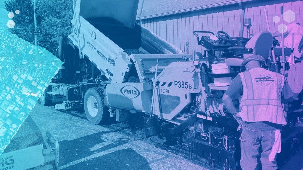
Plan It. Build It. Track It.
From planning reviews to building inspections, handle every step of the process with a flexible platform built to match your workflows. Customize forms, automate approvals, and manage it all in one place.

Submittals Made Simple
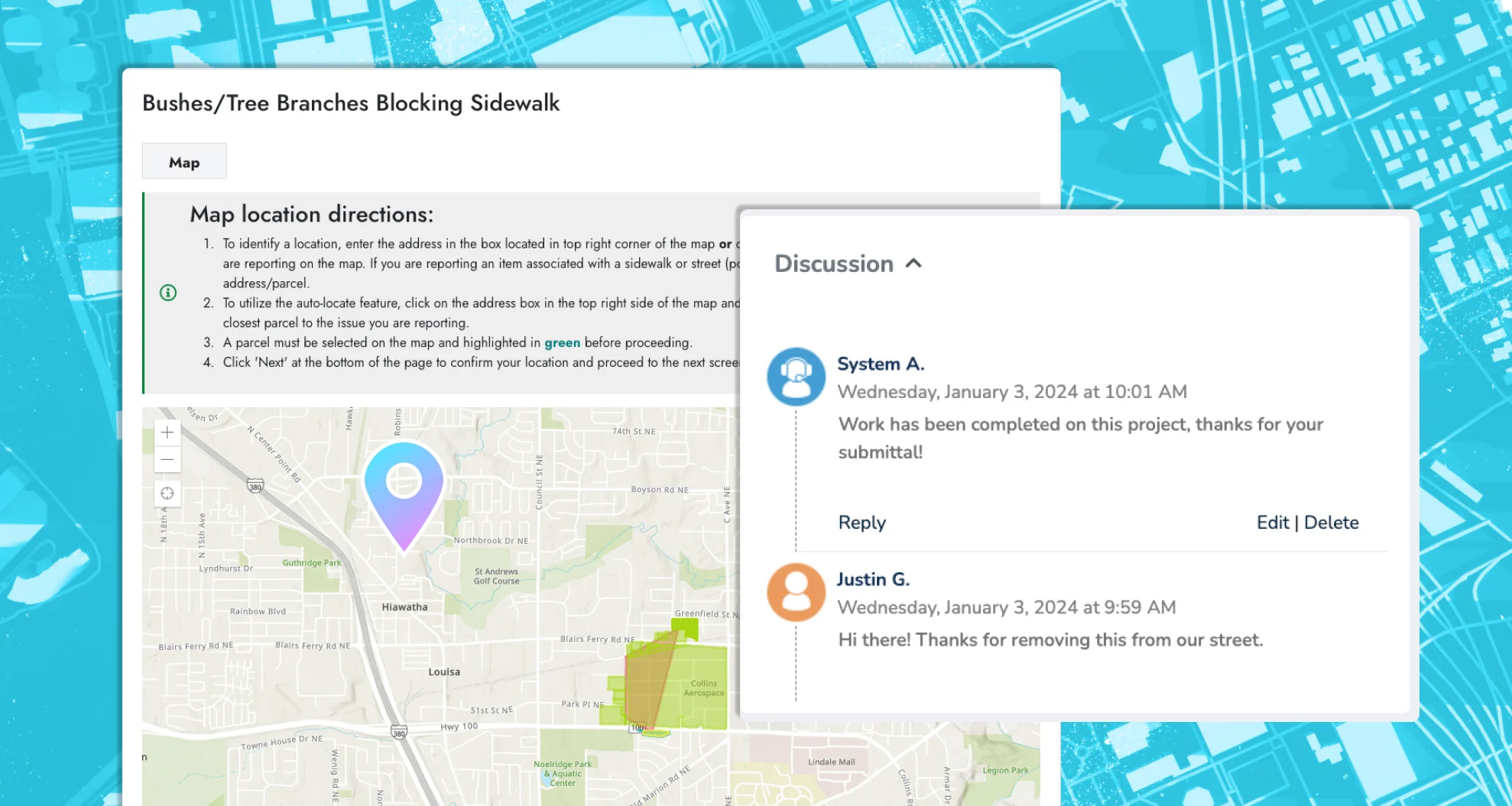
Make it easy for applicants to submit permits, plans, and forms online through your custom-branded portal. Automatically connect each application to the right parcel, zone, or project area for faster reviews and better recordkeeping.


Built to Fit. Not Pieced Together.
Plays nice because it was built to.
Our platform is a single, unified system built specifically for community development teams. Every feature is designed by one team with one purpose: to streamline your processes and support smart, sustainable growth across your community.
Managing permits, planning, zoning, and inspections across disconnected systems often leads to delays and miscommunication. With our fully integrated solution, everything works together in one consistent platform, helping you move projects from application to approval with clarity and confidence.

One Platform to Rule the Workload
Handle assets, requests, inspections, and more without switching systems (or losing your mind).
Permits, inspections, approvals, and planning—handled. Novotx brings it all together so you can keep projects moving forward, citizens informed, and red tape to a minimum.
Built for Community Development,
Plan to Final Inspection
From planning and zoning to permits and inspections—manage every part of your community development process in one connected system. Everything works together to streamline reviews, track progress, and keep your team and your community moving forward.
Permits & Inspections

Whether it’s a building permit or a zoning request, applicants can submit everything online through your custom-branded portal. Track inspections, fees, follow-ups, and approvals in one system.
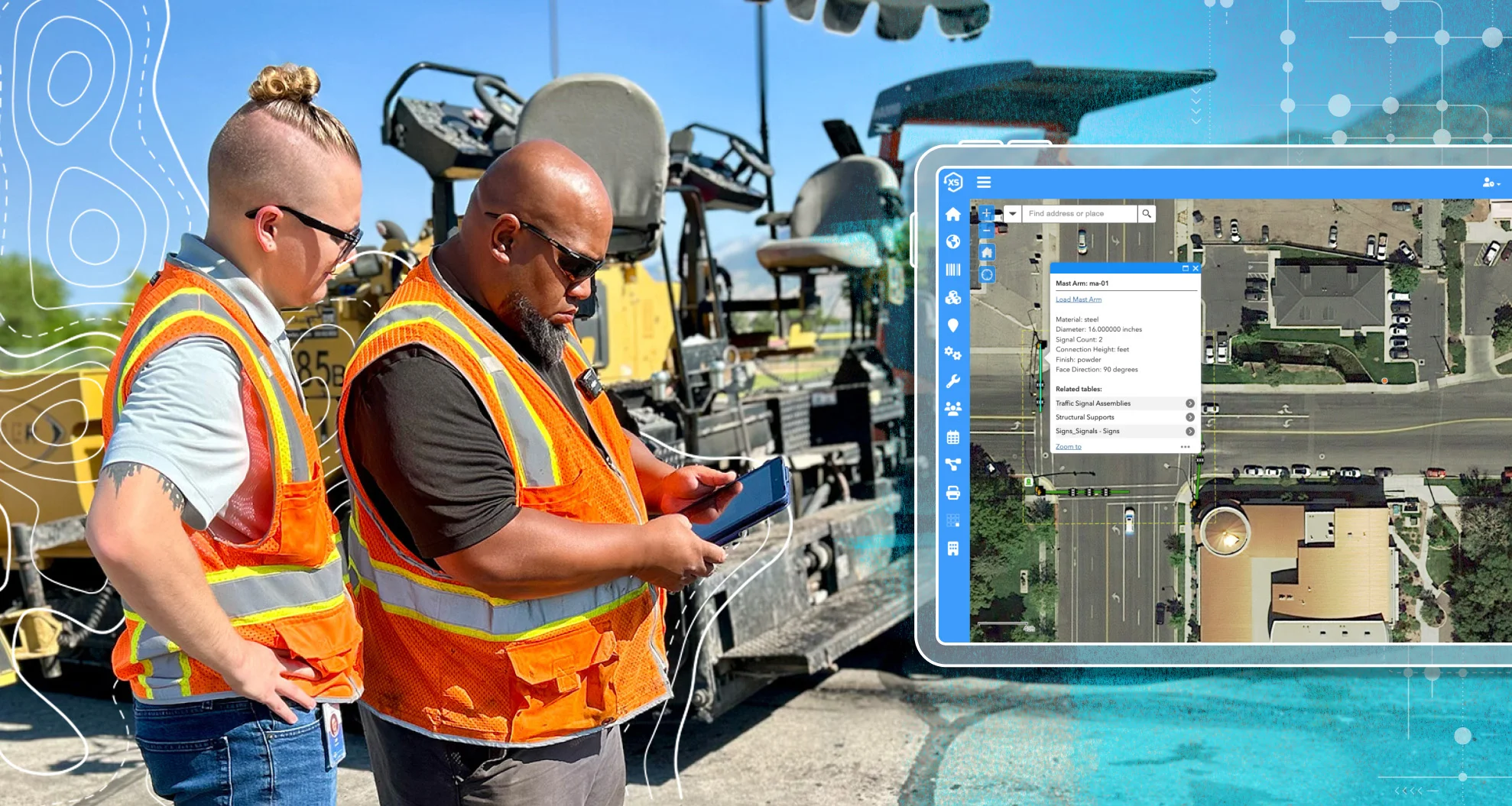
Work Anywhere

Review applications, complete inspections, and issue permits from the office or the field, no matter the device. Applicants can submit from home, and your team can process everything without missing a beat.
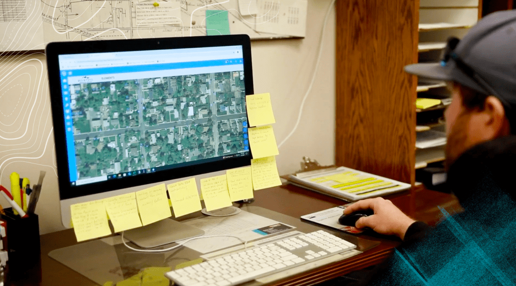
Map Everything

Click any parcel on the map to view all related activity, past and present. With seamless Esri ArcGIS integration, you can access permits, applications, inspections, and regulations instantly, all in one place.
Finally, a Better Way to Work
Give applicants the modern experience they expect with online submittals that flow directly into the same system your teams already use for permits, requests, billing, and more. One system, zero silos.
One System. Every Step.
From zoning requests to final inspections, manage the entire community development process in one powerful platform. With all departments using the same system, your team gets better coordination, fewer silos, and smoother workflows from start to finish.

A Portal That Works for Everyone
Give applicants a modern experience with a custom-branded online portal. From permit applications to special land use requests, everything can be submitted, paid for, and tracked online—no phone calls or office visits required.
Stay Connected Automatically
Keep applicants and staff in the loop with automated status updates, notifications, and easy access to application records. Everyone knows where things stand without needing to ask.

Smarter Decisions with Better Data
Use built-in dashboards and ArcGIS-powered maps to visualize your workload, spot trends, and make informed decisions. From business risk scoring to report generation, you’ll always be one step ahead.
Build Your Ideal Workflow
Tailor every piece of the process—from applications to approvals—so your team and your community get exactly what they need.

Make It Yours
Easily adjust page layouts, menus, lists, and views so your team sees exactly what they need—and nothing they don’t.

Automate What Matters
Streamline your day-to-day with custom automations that handle follow-ups, route reviews, trigger inspections, and send updates—without lifting a finger.

Smart Maps, Smarter Work
Take action directly from the map. Link parcels to applications, update records, and assign tasks—all powered by real-time ArcGIS integration.

Ping the Right People
Set up automatic notifications for key milestones and updates so staff and applicants always know what’s happening—no extra calls required.

Custom without the Chaos
Create unlimited forms, fields, automations, and workflows to match your exact process. No limits, no workarounds, just control.

Anytime, Anywhere
Log in from the office, field, or home—on any device, with or without internet. Stay connected and productive wherever the job takes you.
Build Smarter, Approve Faster
Let’s simplify permits, planning, and everything in between.