
LAND MANAGEMENT SOFTWARE FOR LOCAL GOVERNMENT
No Plot Twists
All your parcels, permits, and plans.
No drama, just data.

Maps Everywhere
Seamlessly link your land management records to your Esri ArcGIS maps. Use your GIS as the single source of truth for all spatial data—keeping your property, parcels, and land assets organized and easy to find.

Your Ideal UX
Track any type of land record or application with a flexible system built for your unique processes. Customize automations, forms, and data sets to create the user experience that fits your team’s needs perfectly.

Simplified Online Processing
Offer constituents a branded, user-friendly portal to submit land applications, permits, and requests anytime, anywhere. Streamline your review and approval workflows with tools designed to speed up processing and reduce headaches.

All Your Land Records,
One Powerful System
A centralized system built to handle all the records and approvals your land department needs.

Permits

Land Use

Rental Applications

Tax Classification

Exemptions

Special
Events

Zoning

Lot Plans
Land
Agreements

Leases

Variances

Reclassification

Built to Fit. Not Pieced Together.
Plays nice because it was built to.
Our platform is a single, unified system built specifically for land management. Every feature is crafted by one team with one goal: to simplify your processes and keep every parcel, permit, and plan moving forward smoothly.
When you’re juggling disconnected systems, things slip through the cracks. With Novotx, everything works together—from zoning requests to lease agreements—on one flexible platform designed to support your entire land management operation.

One Platform to Rule the Workload
Handle assets, requests, inspections, and more without switching systems (or losing your mind).
Track easements, leases, parcels, and more—without the clutter. Novotx gives your team clear records, location-based tracking, and an easy way to manage every inch of your land portfolio.
Built for Land Management,
From Parcels to Permits
Manage every aspect of your land—from parcels to permits, zoning to usage—all within one unified system. Track assets, process applications, monitor compliance, and keep your operations running smoothly from start to finish.
Online Applications

Process zoning permits, subdivisions, land use approvals, and more with fully customizable forms and fields.
Easy Payments
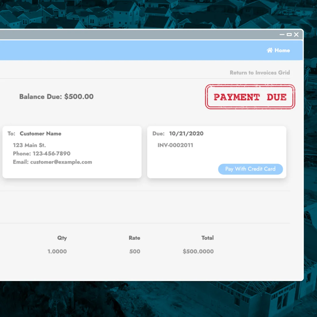
Set up unique fees and collect payments online for a smooth, efficient workflow.
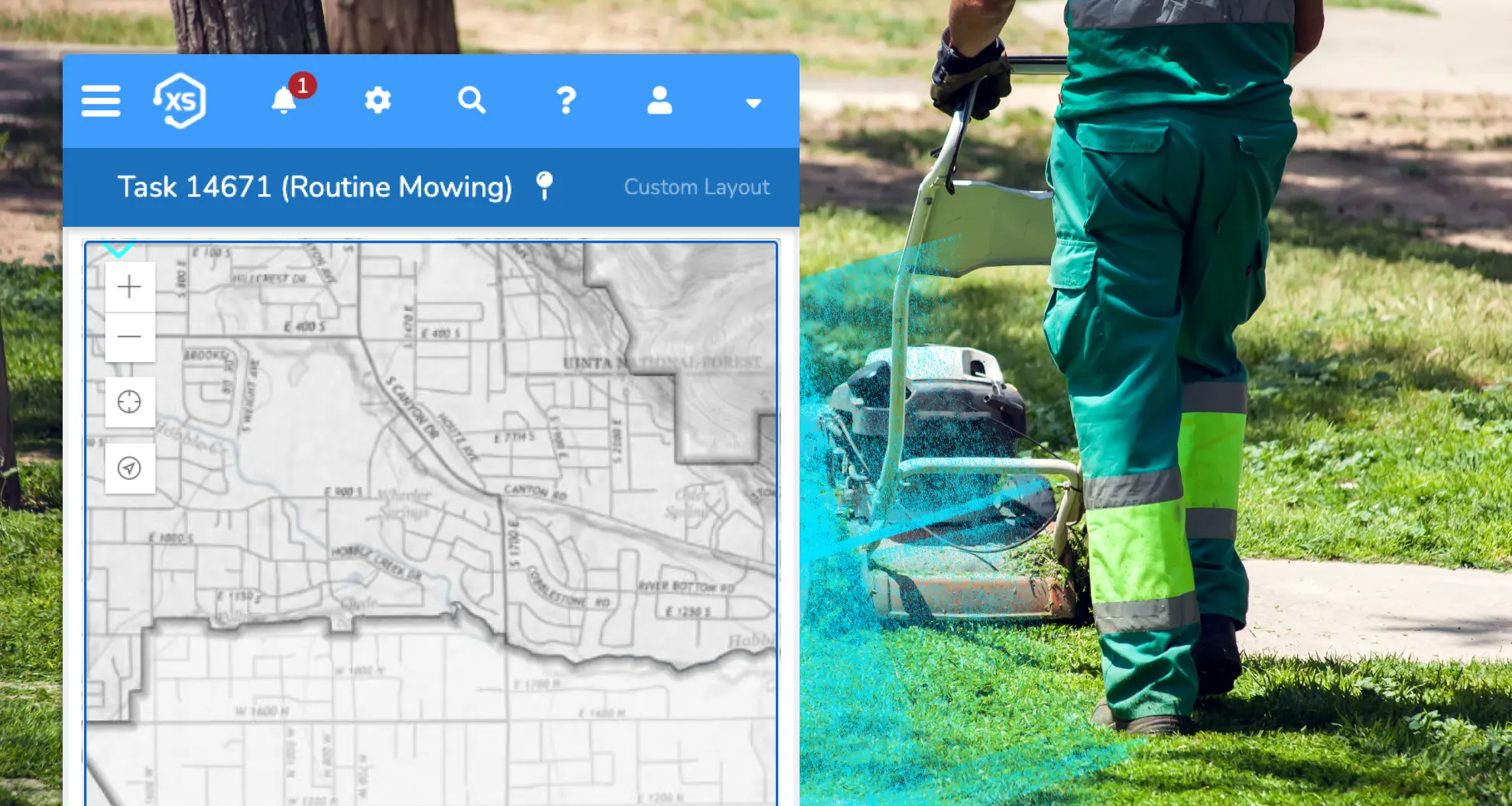
Maps in Sync

Seamlessly connect to Esri ArcGIS for real-time data with no duplication or syncing issues.
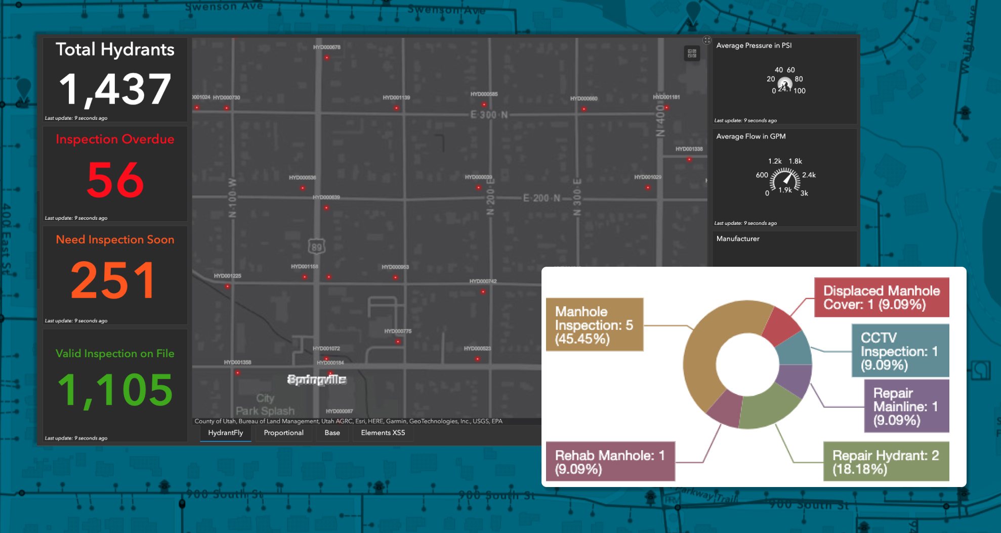
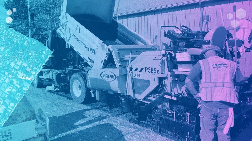
Asset & Work Management
Easily track and manage every land parcel, easement, and infrastructure asset in your jurisdiction. Prioritize maintenance and repairs using condition scoring and risk analysis. Create and assign work orders that capture labor, materials, and equipment costs to help you plan budgets and optimize resources. All asset data stays connected and up to date across your entire team.

Calendars & Scheduling
Keep your team on track with integrated, easy-to-use calendars that manage inspections, compliance reviews, and follow-up tasks. Schedule field visits, public hearings, and renewal deadlines to ensure nothing slips through the cracks. Custom automations can trigger reminders and alerts based on key dates and conditions, helping you meet regulatory requirements efficiently.
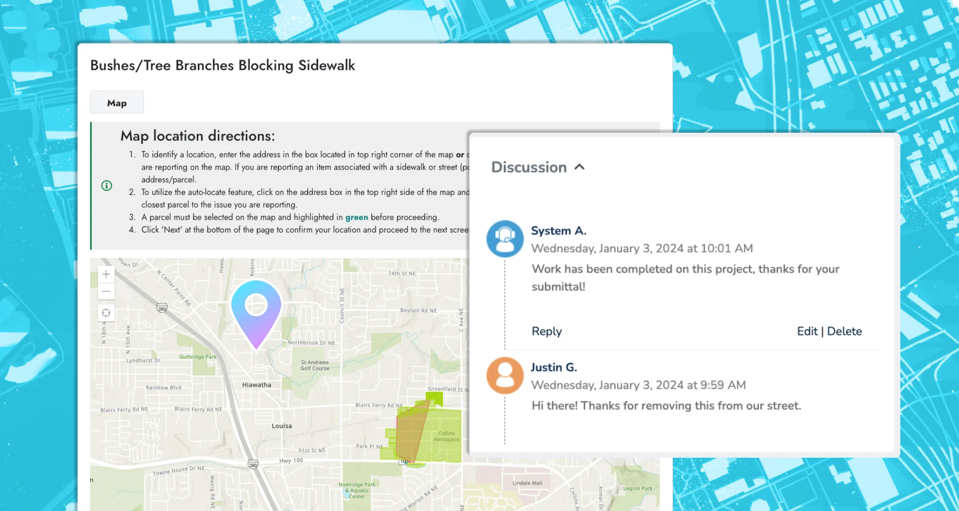
Application Approvals
Streamline the entire application workflow—from initial submission to final approval. Configure customizable review steps, automate notifications, and track application statuses in real time. Whether it’s zoning changes, land use permits, or subdivision requests, stay organized and keep applicants informed with a branded, user-friendly online portal.
Create Your Perfect Setup
Customize your workflows, automate the busywork, and get the job done, whether you’re in the office or out in the field.

Make It Yours
Customize your interface with unlimited fields, forms, and automations tailored to how your land management team works best.

Set It and Forget It
Build unlimited automations to handle follow-ups, task assignments, routing, notifications, and all those unique workflows that keep your operations running smoothly.

Put it on the Map
Leverage seamless ArcGIS integration to update multiple land assets at once. Instantly add labor, materials, and equipment costs with a single click.

Ping the Right People
Set up notifications for any scenario—inspection reminders, status updates, or escalations—to make sure your team and stakeholders stay informed.

Custom without the Chaos
Create endless custom forms, record layouts, lists, fields, and automations to build a system perfectly tailored to your needs.

Anytime, Anywhere
Access your work anytime, anywhere, on any device—even offline. Stay productive no matter where the day takes you.
Mitigate Risk
Maintain a clear digital history of your parks, trails, and facilities as they change over time. Track conditions, monitor sensitive areas, and use smart scoring tools to prioritize maintenance—helping you protect and preserve every green space.
Give Back to Your Land
With modern technology to better manage her resources.