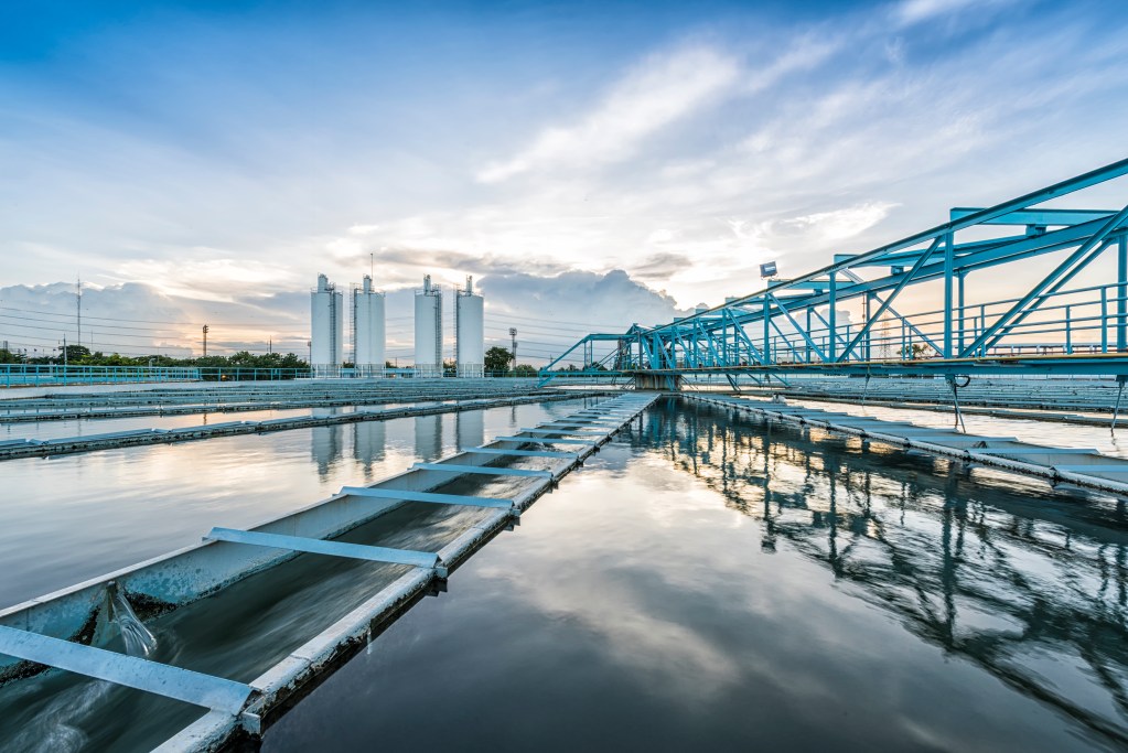
ENTERPRISE ASSET MANAGEMENT FOR WATER UTILITIES AND LOCAL GOVERNMENT
Water You Waiting For?
Dive into software that keeps things flowing.

Your Main Squeeze
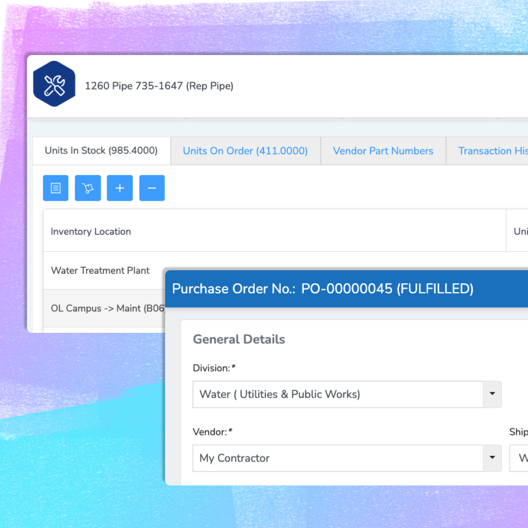
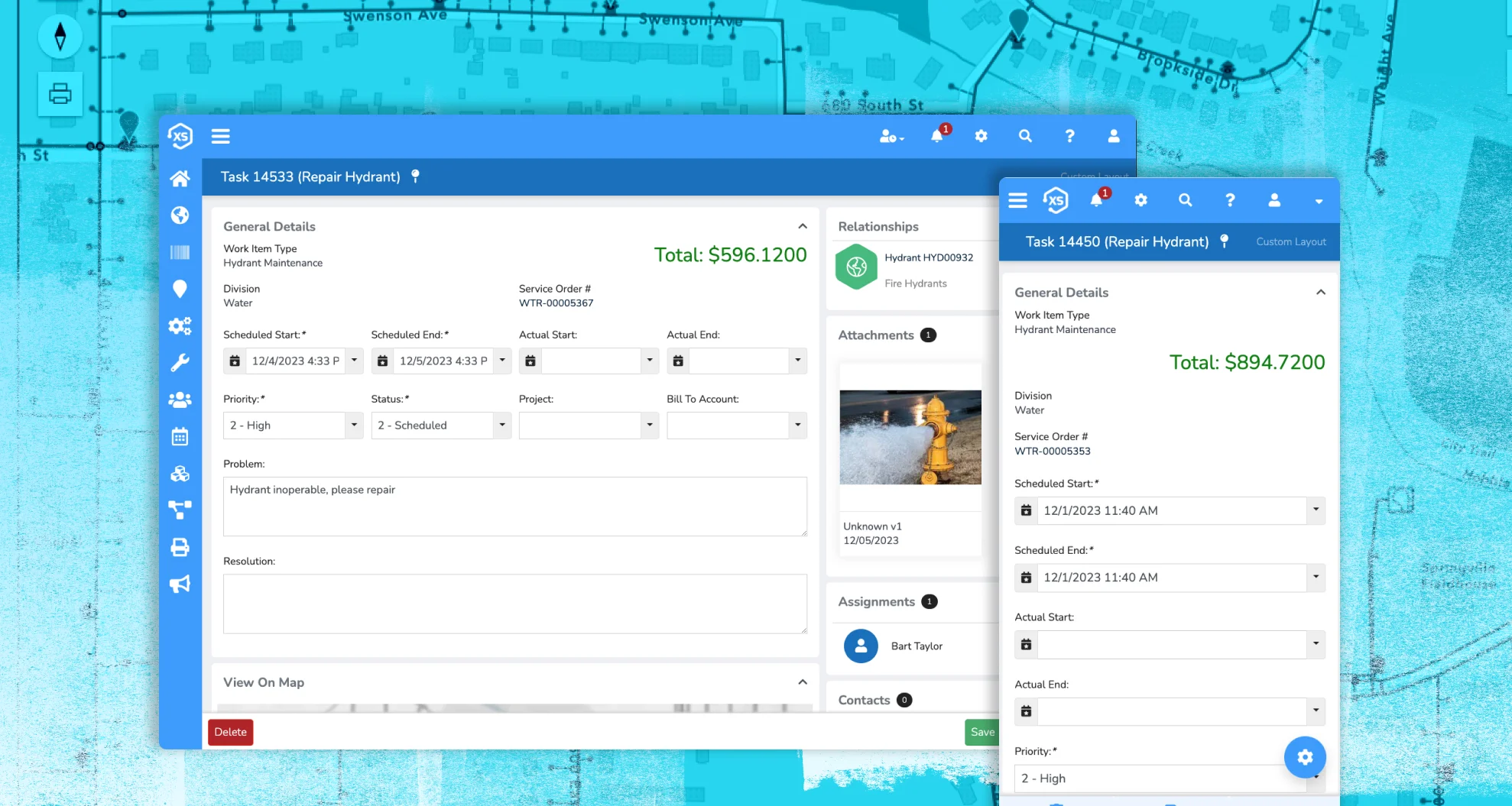
Manage every part of your water utility—from asset tracking and maintenance to citizen service requests—all within a single, easy-to-use interface. No juggling multiple tools or systems; just one platform that works seamlessly from the office to the field.

Maps Everywhere
Bring your water assets to life with native Esri ArcGIS web maps and apps fully embedded in the platform. View, update, and analyze everything on the map, whether you’re tracking pipelines, valves, or service areas—exactly the way your team is used to.

Your Ideal UX
Tailor the interface to fit the unique workflows of your water utility. Customize forms, dashboards, and menus to match how your team works best—making everyday tasks faster, easier, and more intuitive for everyone, from dispatchers to field crews.


Built to Fit. Not Pieced Together.
Plays nice because it was built to.
Because our platform is built by a single team with a shared vision, you get a seamless experience, not a patchwork of disconnected tools.
We offer direct, real-time integration with Esri’s ArcGIS system throughout the platform. That means your maps aren’t just visual—they’re fully functional, letting you manage assets, trigger work, and make data-driven decisions all in one place.
No bolt-ons. No workarounds. Just one unified system built to simplify your operations.

One Platform to Rule the Workload
Handle assets, requests, inspections, and more without switching systems (or losing your mind).
Everything’s connected—because it should be. With Novotx, you get one platform that brings it all together: work orders, permits, GIS, customer requests, and more. No more jumping between disconnected tools or re-entering the same data twice. Just one place to track it, manage it, and get it done.
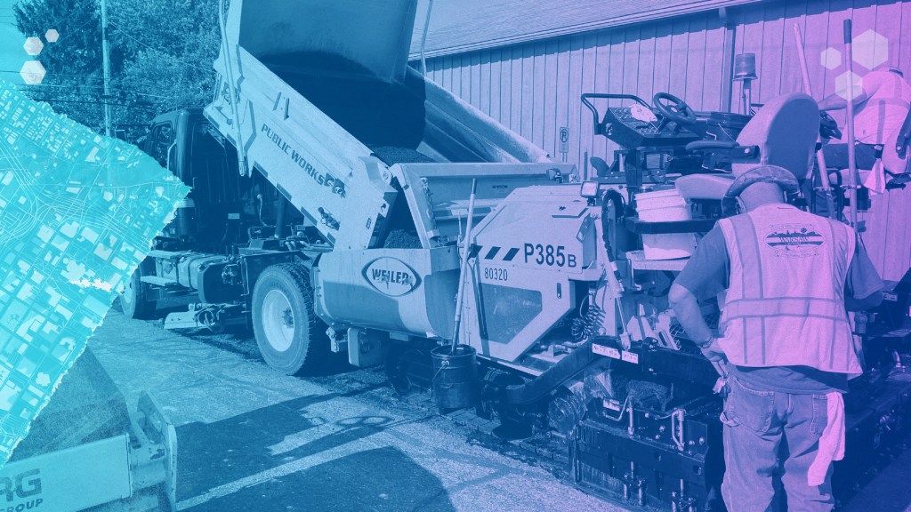
Built for Water Utilities That Do It All
From the field to the front office, Novotx brings every part of your operation together—so you can get more done with less hassle.
Built for Water

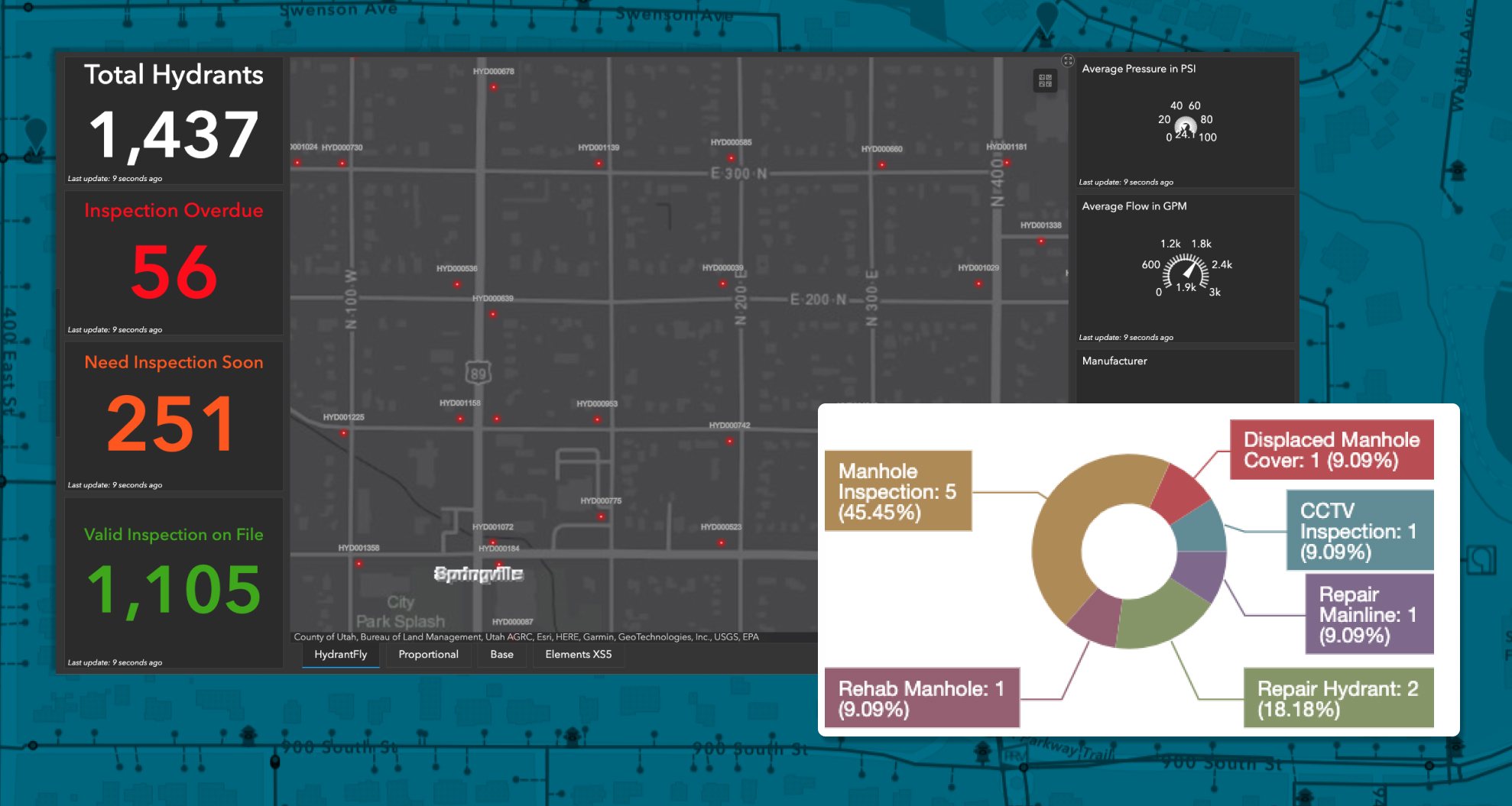
Track assets, process requests, manage work orders, and keep your team in sync. Pre-built templates, designed for water utilities, including asset scoring and risk-based prioritization, help you get started fast and stay focused on what matters.
Smarter Tools
See the full picture with integrated tools that track labor, equipment, materials, and contractor costs on every job. No more guesswork—just clean, connected data that helps you plan better and work smarter.
Maps That Do More
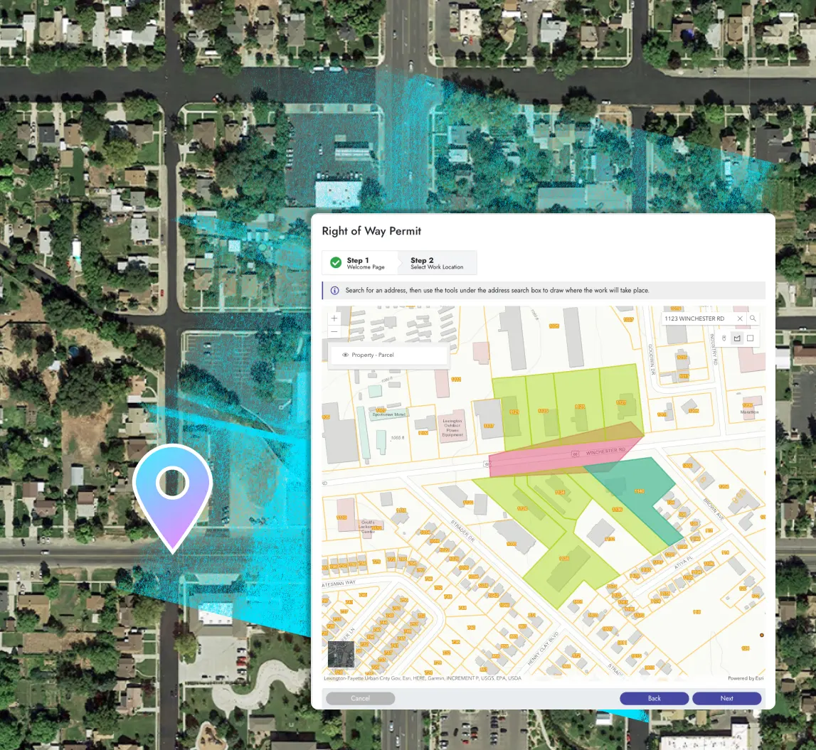
Use your existing ArcGIS web maps and apps throughout the platform—with zero duplication or syncing delays. Whether you’re in the office or out in the field, your maps are ready to power every task, inspection, and decision.
Don’t Worry, Be Mappy
Elements XS delivers seamless integration with Esri’s ArcGIS—so your water utility can use native web maps and apps right inside the platform.

Say Goodbye to
Sync Hassles
Your GIS is the single source of truth for all your water assets. Elements XS eliminates the need to sync or copy data, keeping your maps and records perfectly up to date—automatically.
Share Live Water Maps
Create public-facing maps that show real-time updates on water assets, service areas, outages, and ongoing projects—keeping your community informed and connected.

Create Your Perfect Setup
Tailor the interface with as many custom fields, forms, and automations as you need. From simple tweaks to full redesigns, it’s all in your hands.

Make It Yours
Shape the platform to fit your unique water operations, from valve inspections to pipeline maintenance, with unlimited forms and fields built for what you do.

Set It and Forget It
Set up automations to route repair requests, trigger follow-ups on leaks, send alerts for hydrant flushing, and keep your crew focused on urgent fixes.

Put it on the Map
Leverage ArcGIS maps to update multiple water assets at once, track valve status, log repairs, and add labor or materials costs with just one click.

Ping the Right People
Send notifications for water outages, completed repairs, or upcoming maintenance, keeping both your field crews and citizens in the loop.

Custom without the Chaos
From service requests to compliance checks, create all the custom forms, fields, and automations you need—no coding required.

Anytime, Anywhere
Get the job done in the field or office, online or offline. Novotx keeps your water utility running smoothly no matter where your team is.
Mitigate Risk
Keep a clear, digital record of how your land and infrastructure evolve over time. Track every change, monitor critical areas, and prioritize attention with smart scoring tools designed to help you stay ahead.
Less Hassle, More H2-Oh Yeah!
So good you’ll wonder how you ever settled for less.